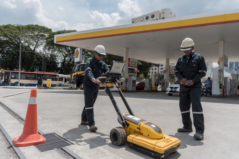
Underground Utility Surveying is the process of mapping subsurface utilities using a combination of geophysical and land surveying techniques. Underground utility mapping refers to the detection, positioning and identification of buried pipes and cables beneath the ground.
Underground Utilities Detection and Mapping deals with features mainly invisible to the naked eyes. Setia Geosolutions examines areas for known and unknown utilities and structures hidden underground which improves the planning as well as implementation of new projects which may be adversely disrupted if UUM is not carried out beforehand.
In Malaysia, utility agencies are private entities or government linked companies (GLCs) benefit greatly from UUM as this technology prevents companies from attempting to construct on areas which has natural or man-made structures obstructing the new development. Market Segments, especially Power, Utility, Property and Infrastructure, Environmental, Government, Aviation, as well as Oil and Gas Industries benefit from the data produced by this surveying method.
Currently, SGS has provided Underground Utilities detection and mapping services to major market
players including Petronas, Gas Malaysia Sdn Bhd, Tenaga National Berhad, Telekom Malaysia Berhad, SYABAS, Indah Water Konsortium Sdn Bhd.

Corporate Overview
Vision, Mission & Values
Top Management
Milestones
Our Clientele
Corporate Information
Awards & Accolades
ABC Policy
Kuala Lumpur
Suite L11-21, Tower 1, Wangsa 118, No.8, Jalan Wangsa Delima, Wangsa Maju, 53300, Kuala Lumpur
T :+(6)03-4144 2344
T: +(6)0386878415
F :+(6)03-4144 2644
E: sgskl@setiageosolutions.com
Whatsapp : +(6)0386878415