Land surveying in Malaysia commonly refers to basic land survey type which is cadastral survey and engineering survey. In this day and age, land survey markets are experiencing shifting of consumer’s priorities and paradigm shift due to new technologies.
Beyond land surveying, there has been rapid advancement in computing, networking, and geospatial data mapping as well as consumer’s demand. Currently, to attain Geographical information, is within reach and effortless due to these modifications.
As a result, society now places a higher value on accurate, timely, and user-friendly geospatial information than ever before. To meet the demands, various types of surveys have been developed. The following are the various types of land surveys available in Malaysia:
Cadastral surveying is the discipline of surveying that deals with the laws of land ownership and the establishment of property boundaries.
It involves interpreting and advising on the location of boundaries, land ownership status, and rights, restrictions, and interests in land, and recording this information for use in plans, maps, etc.
It also includes the physical delineation of land and the determination of dimensions, areas, and certain rights associated with land, whether located on land or water or defined by natural or man-made features.
Cadastral surveys are usually conducted to divide the land into parcels and to redefine the boundaries of previously surveyed land in order to determine the physical extent of ownership or to facilitate the transfer of title.
There are two (2) types of cadastral survey:
An engineering survey is a survey of a land parcel that is used to determine the best location for infrastructures such as roads, railways, or pipelines. There are different types of engineering surveys:
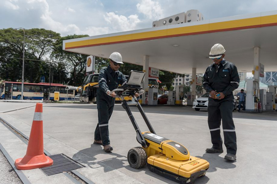
The process of locating buried utilities is known as underground utility mapping. These underground assets could include telecommunication, electricity, natural gas, and water lines.
It becomes even more complicated in the urban area, where utilities compete for underground space with subways, rail lines, and road tunnels.
Generally, in the cities area, underground utility detection equipment such as Pipeline Cable Locator and GPR systems, generally, could only detect depths up to approximately 2 meters to 3 meters with positional accuracies of +/- 0.1m to 0.3 meters.
The depths of detection capability correlates directly to the soil type and ground conditions. The detection work will determine the presence of any buried power cables, metallic utilities (steel pipes and copper telecommunication lines), and to some extent, non-metallic utilities (fibre optic ducts) that are accessible.
The range of detection, accuracies, and capability of detecting the buried services depend on the soil conditions. It may only sometimes be possible for some utilities (particularly the non-metallic ones) to be detected.
Underground utility mapping is a survey to create a digital representation of the underground systems in a geographic area. The survey uses ground penetrating radar and electro-magnetic locators to generate a detailed below-surface profile.
Hydrographic surveying or bathymetric surveying is the surveying of physical features underwater.
It is the science of measuring all factors underwater that affect all maritime activities such as dredging, marine construction, offshore drilling, etc. Hydrographic survey is mainly carried out on behalf of government agencies.
It is mainly carried out using sensors, soundings or electronic sensor systems for shallow waters.
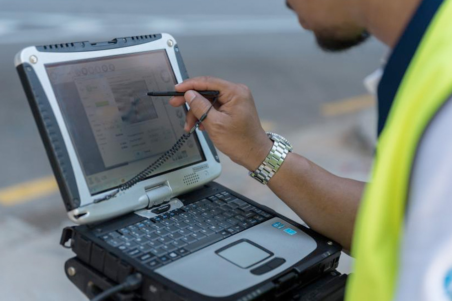
Terrestrial laser scanning is a surveying method that provides detailed and highly accurate 3D data in a timely and efficient manner. This technology is becoming increasingly important for surveying applications.
Applications are diverse and include topography, mining, as-built surveying, architecture, archaeology, monitoring, civil engineering and urban modelling.
The terrestrial laser scanner is a non-contact measurement device that can capture densepoint clouds of objects. After processing, X, Y and Z coordinates, colour and reflectance value are assignedto each point. The relative precision, i.e. the ratio between absolute precision and measurement range, is better than 10-4.
Mobile mapping is the process of collecting geospatial data from a mobile vehicle, typically fitted with a range of GNSS and 360-degree panorama camera.
Mobile mapping systems can be used to acquire high-resolution and precise data quickly. With its patented calibration and superior global shutter sensors, the camera can captures high-quality images with an accuracy level of 10 cm with 10 m radius from the center of the camera.
Corporate Overview
Vision, Mission & Values
Top Management
Milestones
Our Clientele
Corporate Information
Awards & Accolades
ABC Policy
Kuala Lumpur
Suite L11-21, Tower 1, Wangsa 118, No.8, Jalan Wangsa Delima, Wangsa Maju, 53300, Kuala Lumpur
T :+(6)03-4144 2344
T: +(6)0386878415
F :+(6)03-4144 2644
E: sgskl@setiageosolutions.com
Whatsapp : +(6)0386878415