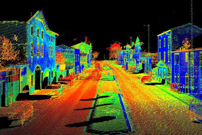
Mobile Mapping System (MMS) involves dynamic digitization of complex environments at very high spatial resolution using a 360 mobile mapping platform. The goal of this services are to capture georeferenced data of spatial objects and integrate them into geospatial applications.
By using Mobile Mapping System (MMS) technology, the photographic image and location information of the objects can be captured using an omnidirectional digital camera mounted on a moving vehicle with the position determined by high accuracy tracking devices and other sensors. The feature data can be identified, digitised and located using the captured images. Over the years, mobile mapping has become one of the most popular geospatial data tools, enabling companies and researchers to capture data faster and create accurate 2D or 3D models, even in difficult conditions.
Nowadays, key factors that are expected to drive the growth of the mobile mapping market are the growing investments in smart city projects, adoption of advanced technology for surveying and mapping and also increasing in use of geospatial data in most of the application. SGS has served clientele from the power industry with survey and analyzing their low-voltage (LV) assets located on-ground and publishing it in Geographic Information System (GIS) platform. Other than that, reliable and accurate geospatial database from mobile mapping can be very beneficial for urban and road planning in the form of digitalizing city infrastructure for smart cities transformation process.
SGS has the privilege of offering our services to:
• Local Authority.
• Government.
• Utility Service Provider.
• Waste Management Division.
• Highway Concessionaries.

Corporate Overview
Vision, Mission & Values
Top Management
Milestones
Our Clientele
Corporate Information
Awards & Accolades
ABC Policy
Kuala Lumpur
Suite L11-21, Tower 1, Wangsa 118, No.8, Jalan Wangsa Delima, Wangsa Maju, 53300, Kuala Lumpur
T :+(6)03-4144 2344
T: +(6)0386878415
F :+(6)03-4144 2644
E: sgskl@setiageosolutions.com
Whatsapp : +(6)0386878415